Reference-map notice: Flood and Landslide Susceptibility Zone labels below are visual interpretations of the supplied MGB map PNGs. They are reference information, not coordinate-level records generated by Import & AutoML.
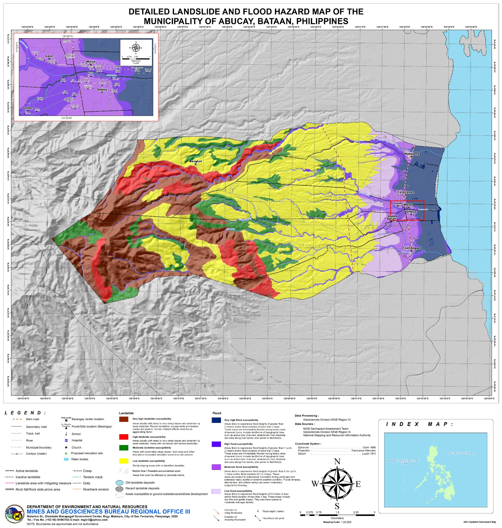
⛰️ Landslide Dominant
2021
🌊 High – Moderate
⛰️ Very High – High
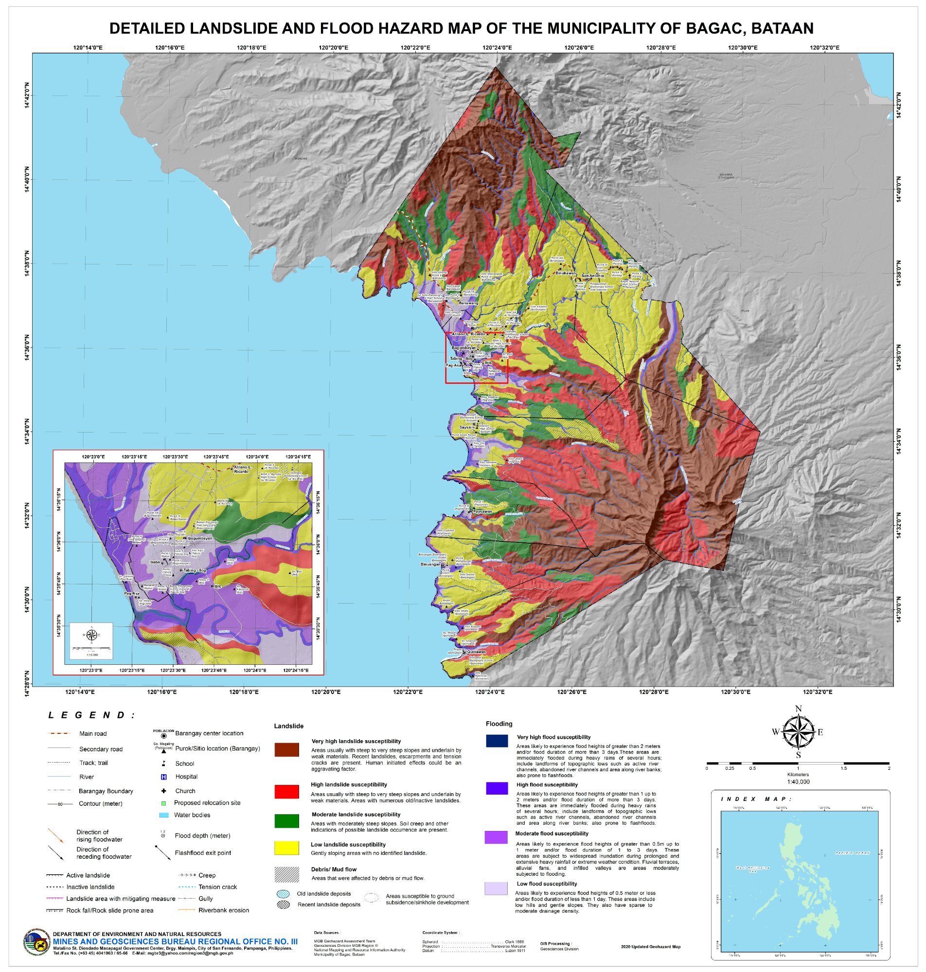
⛰️ Landslide Dominant
2020
🌊 Moderate – High
⛰️ Very High – High
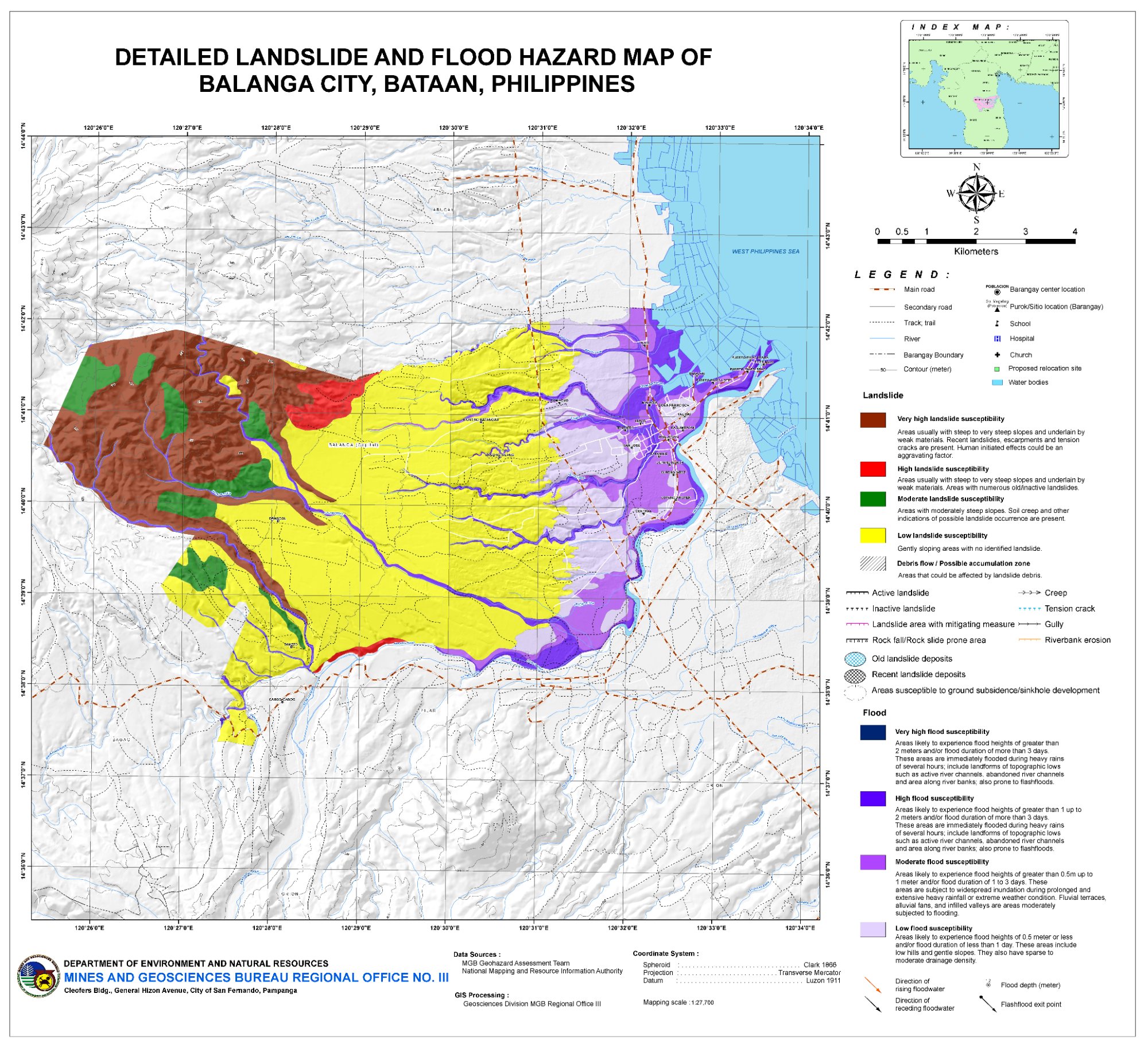
🌊 Flood Dominant
2016
🌊 Very High
⛰️ Low–Moderate
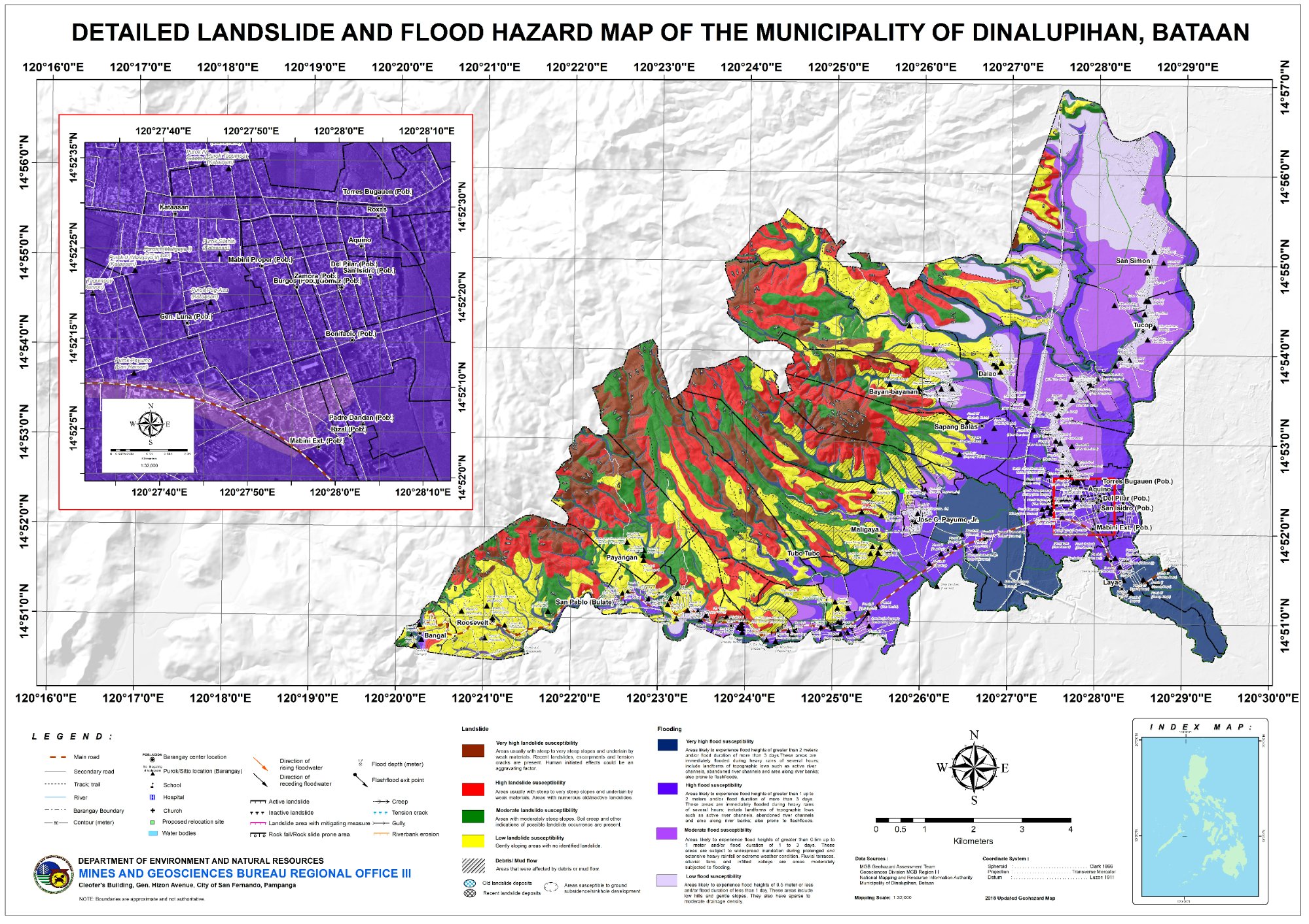
✅ Low Hazard
2018
🌊 Low – Moderate
⛰️ Moderate – High
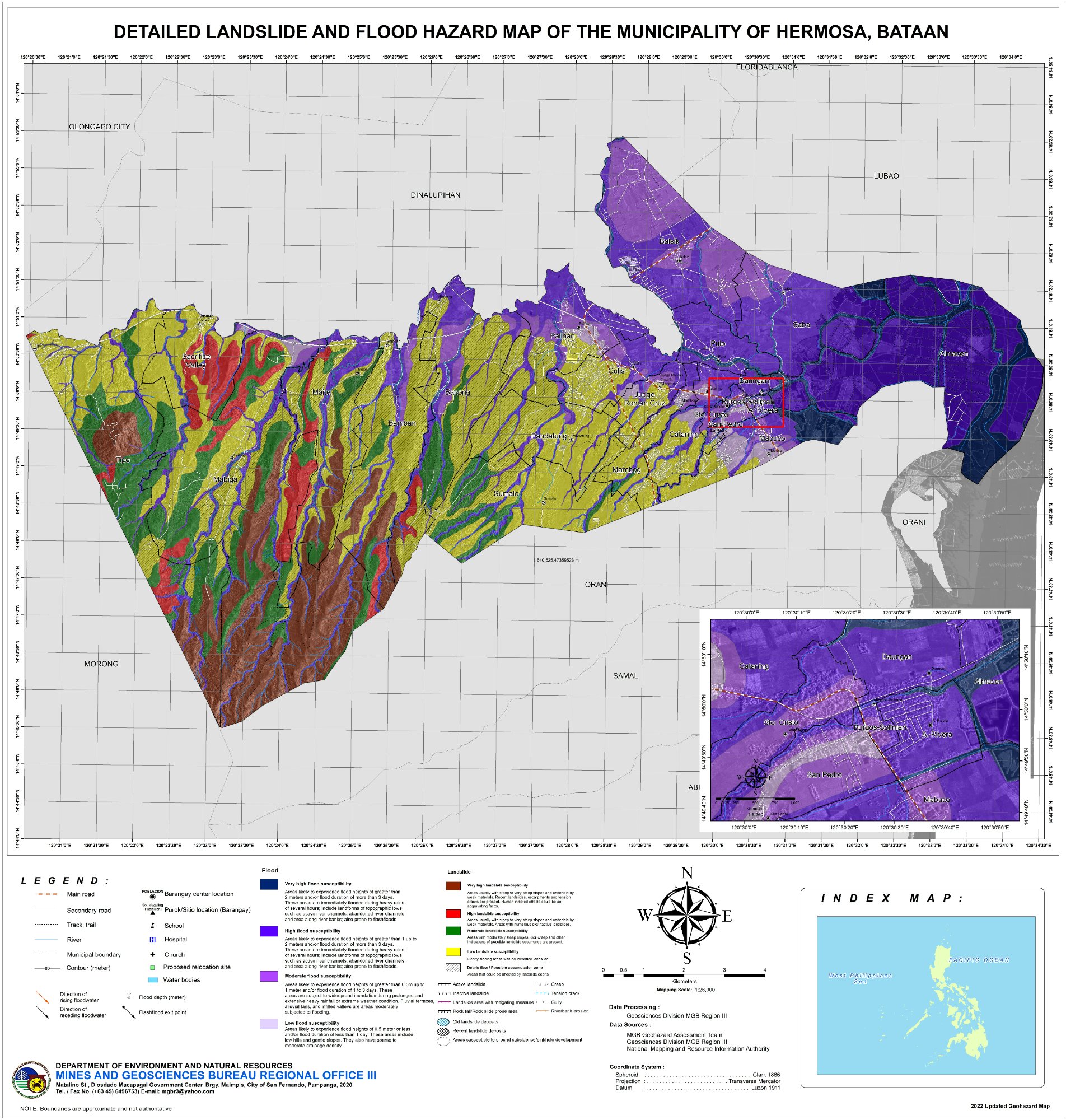
⚠️ Dual Hazard
2022
🌊 High – Moderate
⛰️ High – Very High
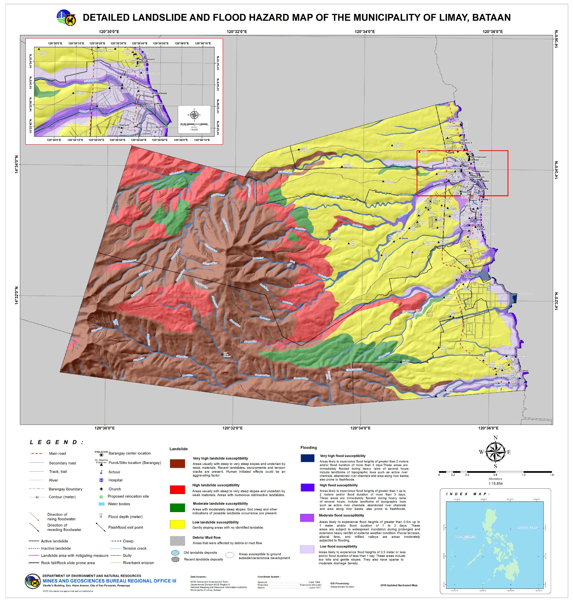
⚠️ Dual Hazard
2019
🌊 High – Moderate
⛰️ Very High – High
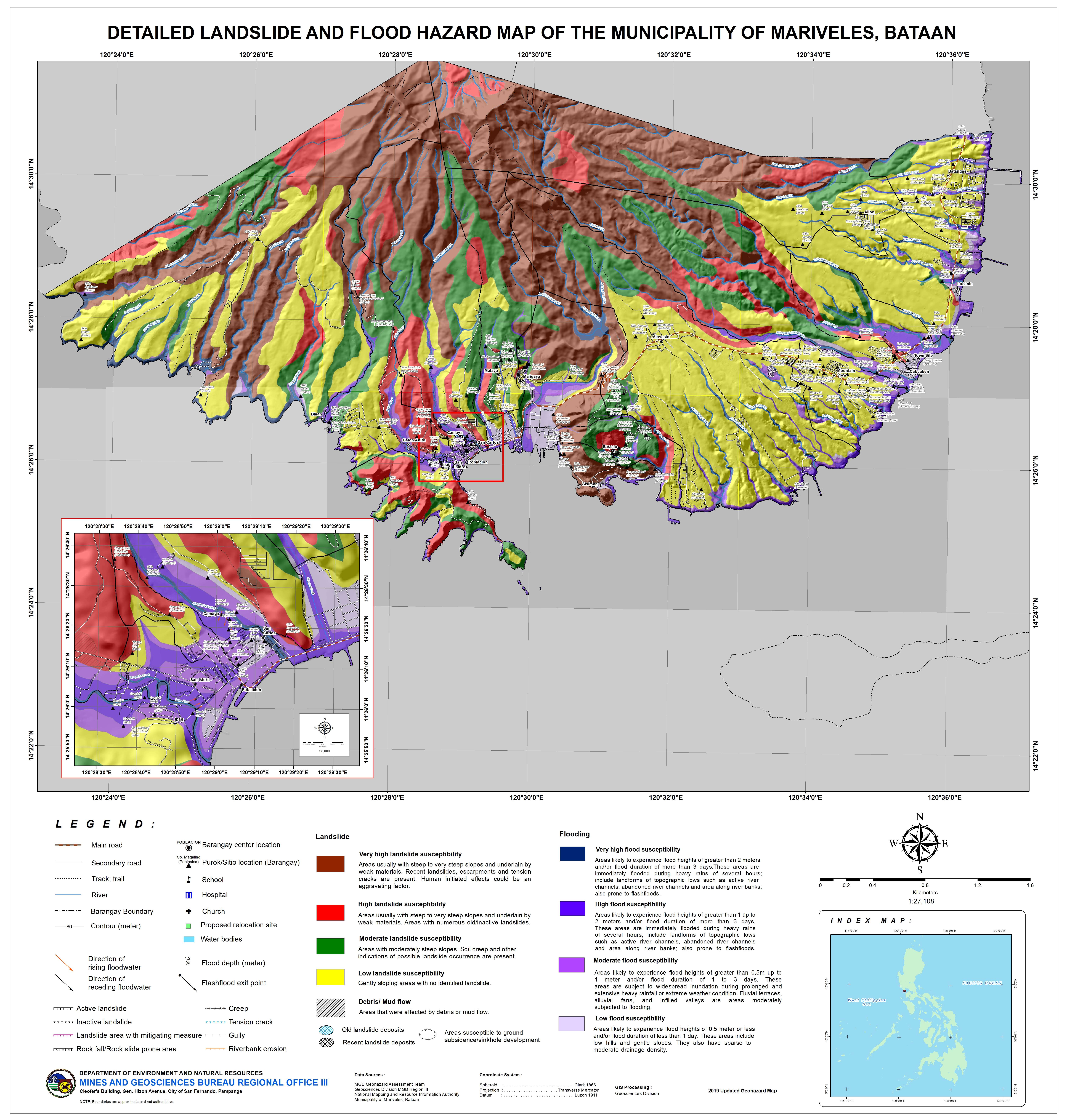
⛰️ Landslide Dominant
2019
🌊 Low – Moderate
⛰️ Very High – High
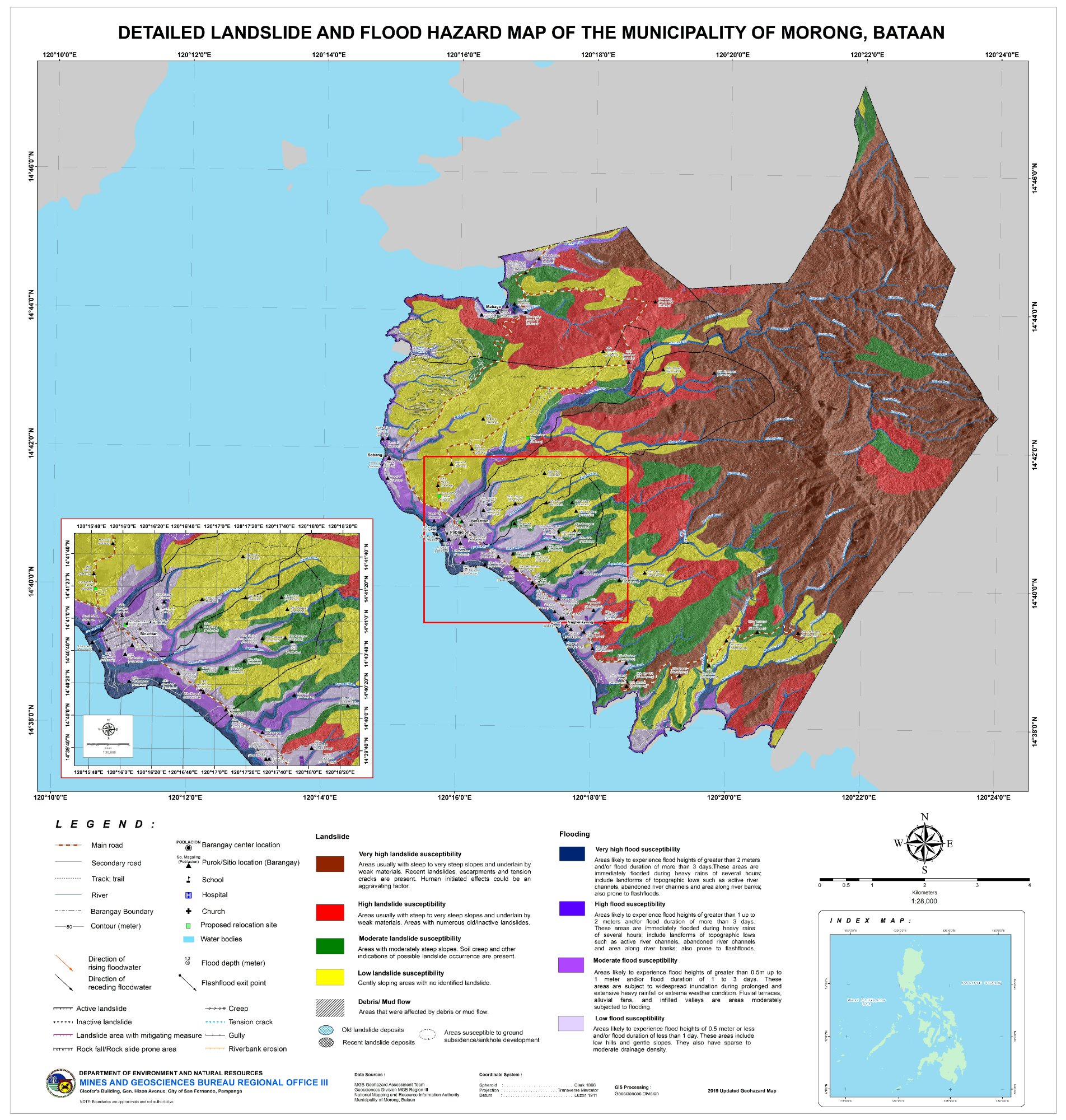
⛰️ Landslide Dominant
2019
🌊 Low
⛰️ Very High – High
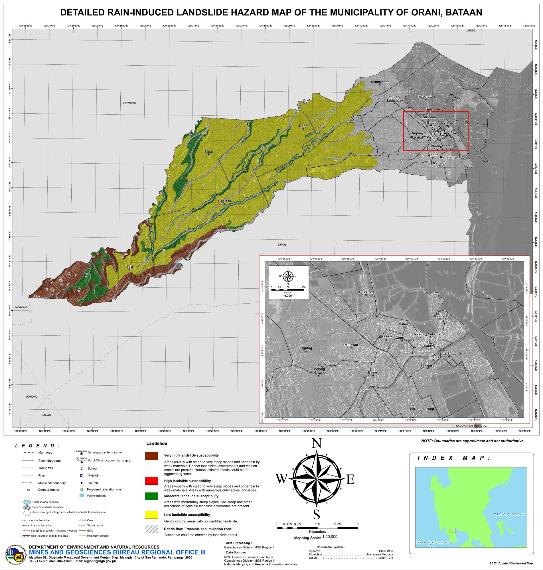
✅ Low Hazard
2024
🌊 Low
⛰️ Low – Moderate
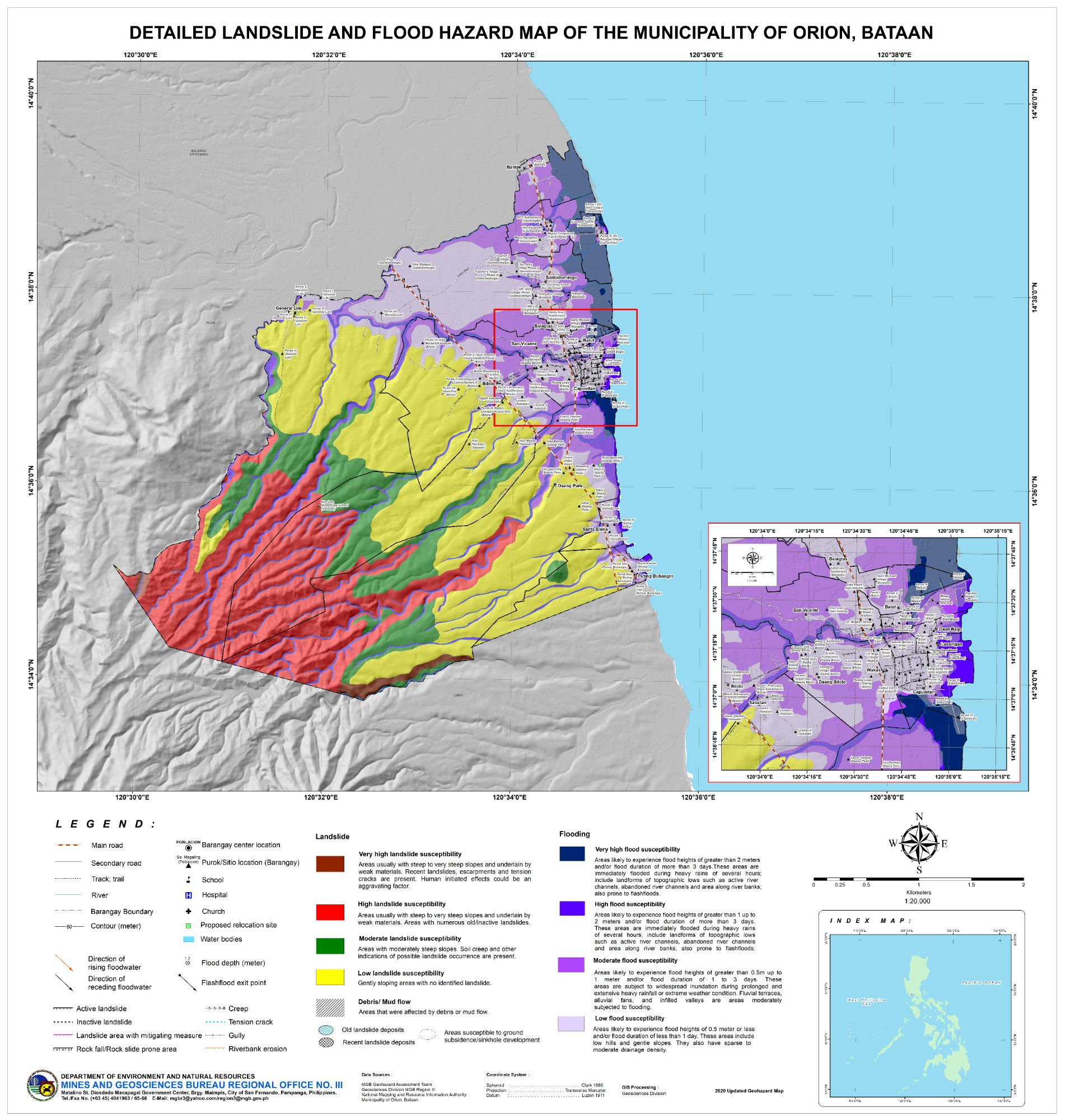
⛰️ Landslide Dominant
2020
🌊 Low – Moderate
⛰️ High – Very High
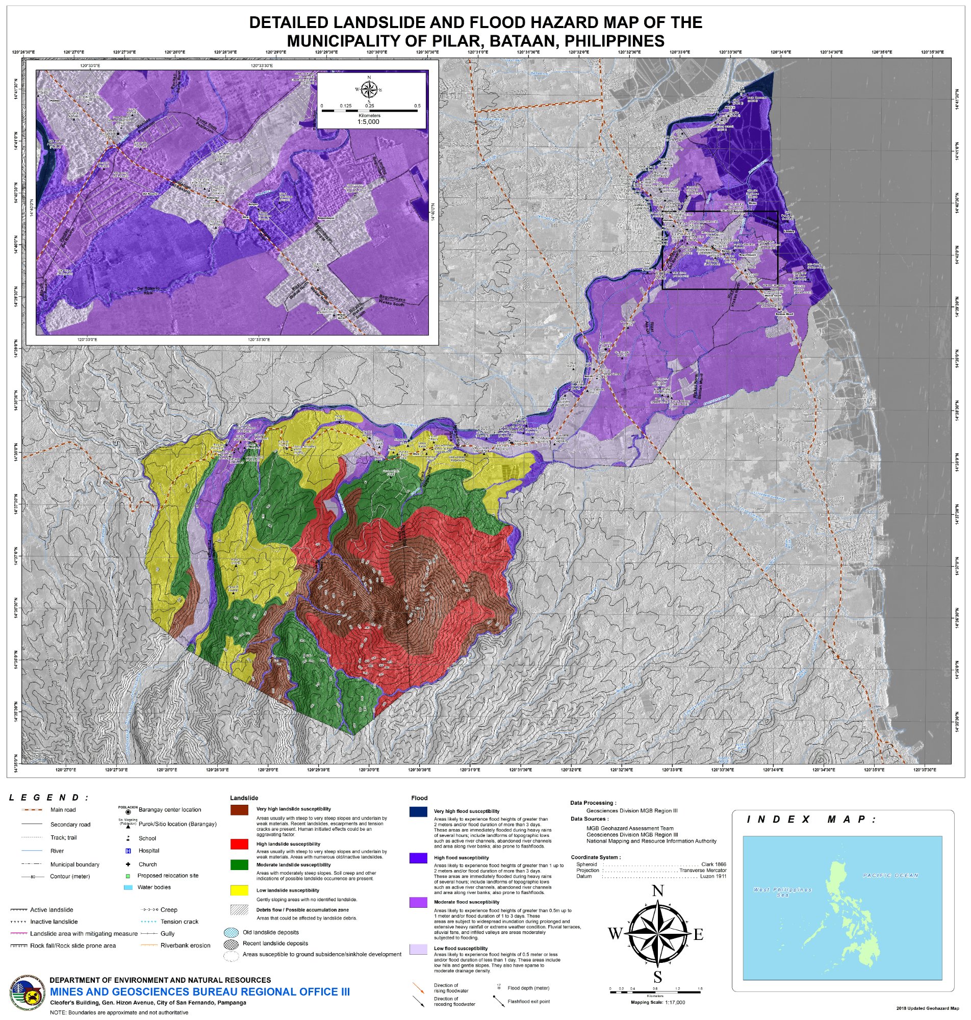
⛰️ Landslide Dominant
2018
🌊 Low – High
⛰️ Very High
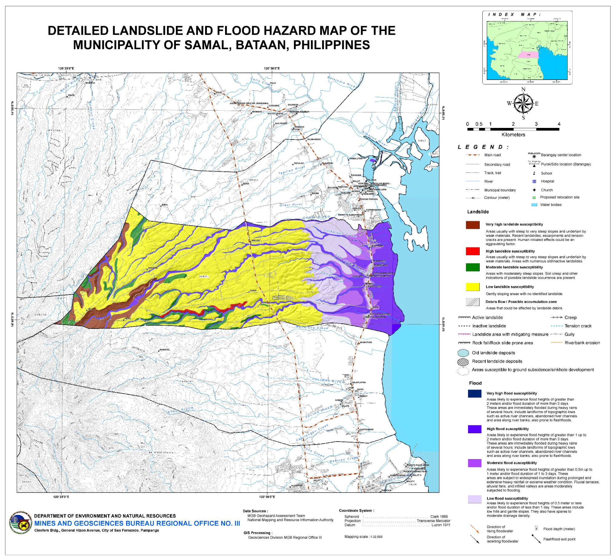
🌊 Flood Dominant
2023
🌊 Very High – High
⛰️ Low
💡
Glance View: Click any municipality card to open the full-screen deep-zoom viewer — pinch/scroll to zoom, drag to pan anywhere on the map. Barangay labels are readable at 3–8× zoom. Click "Full Detail" for complete hazard zone tables and analysis.
100%
Scroll or pinch to zoom · Drag to pan anywhere